Unlimited Digital Access / Get £25 off your Annual Digital Subscription! Use code 25OFF
GET STARTEDMore on KentOnline
Unlimited Digital Access / Get £25 off your Annual Digital Subscription! Use code 25OFF
GET STARTEDMore on KentOnline
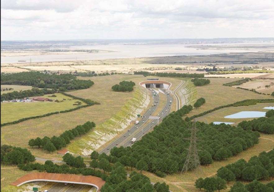
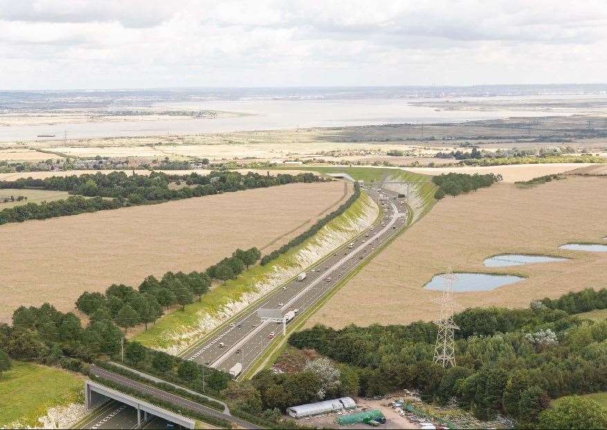
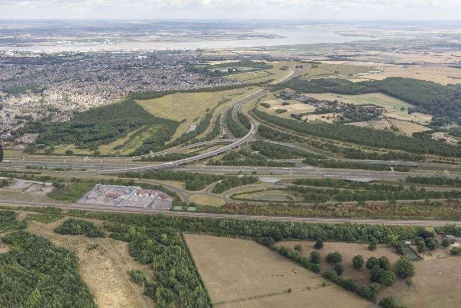
New images show how the design of the planned Lower Thames Crossing has change since consultation began on the project.
National Highways has published a new 'interactive tool' showing how consultation has shaped the crossing - which will be longest road tunnel in the country, linking Essex to Kent, near Gravesend.
The controversial 14-mile link road would cost between £6.8bn to £8.2bn, and National Highways say it will double road capacity across the Thames east of London.
Planners are now aiming to submit a new planning application and hope construction could start in 2024.
Visitors to the National Highways website can explore maps, images and videos that illustrate how the plans have changed - including alterations to the road and junctions.
Key changes include an extension to the tunnel, moving its southern entrance a total of 950 metres further away from the river than originally planned, away from nearby protected wetland and reducing the impact on Ancient Woodland.
The M2/A2 junction near Gravesend has been redesigned to provide a more compact layout, which planners say has reduced the land needed and allowed the tunnel to be extended 350 metres south.
The A226 junction has been removed, which designers say will reduce the impact on the road network, air quality and noise receptors around Higham.
Other changes include lowering the height of the road, and reducing the number of lorries needed during construction from 17,500 to 9,500 by re-using excavated material on site to create landscaping features and two new public parks.
Mark Bottomley, Deputy Project Director, Lower Thames Crossing, said: “It is important we make rapid progress on tackling the issues at Dartford that are a barrier to growth. The Lower Thames Crossing will almost double road capacity across the Thames and ease congestion at Dartford.
“We’ve carried out a huge programme of engagement and consultation with our stakeholders and communities to improve the design of the Lower Thames Crossing and reduce our impact on our neighbours and the environment.
"We have designed around 80% of the new road below ground level or behind false cutting and added two new public parks – one on the north bank of the Thames and one at the southern tunnel entrance. We're grateful to our stakeholders and local communities for taking the time to give us feedback and help us shape our route and how we will build it.”

National Highways say they aim to submit an application within the coming weeks, and again welcome further feedback.