Unlimited Digital Access / Get £25 off your Annual Digital Subscription! Use code 25OFF
GET STARTEDMore on KentOnline
Unlimited Digital Access / Get £25 off your Annual Digital Subscription! Use code 25OFF
GET STARTEDMore on KentOnline
Kent is due to be hit with heavy downpours in the coming days.
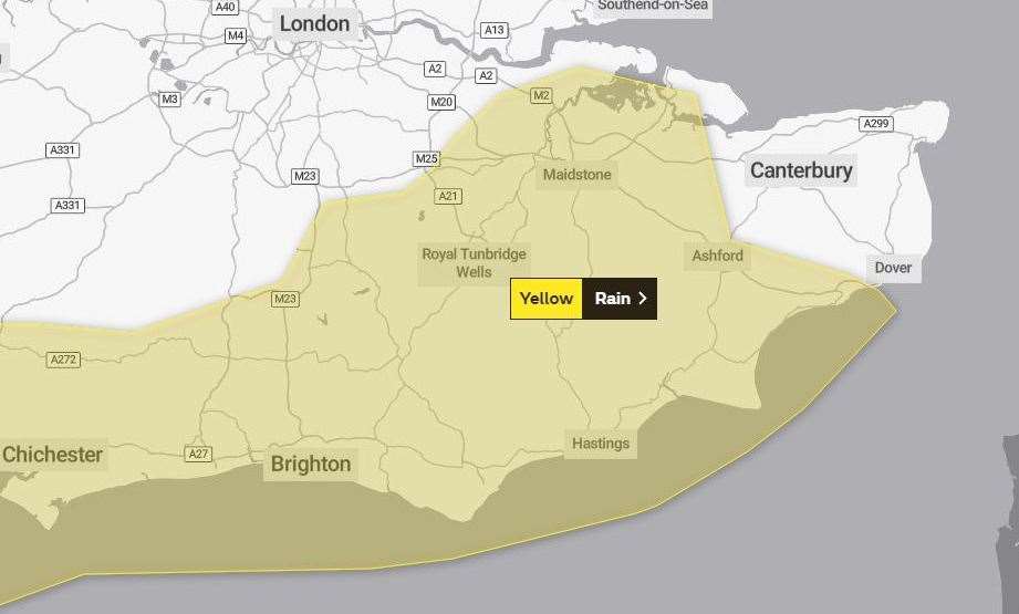
The Met Office has issued a yellow weather warning for large parts of the county, with up to 30mm of rain expected.

It comes after flood alerts have been issued for land next to the River Medway, Beult and Stour and other parts of the county.
Alongside flooding, power cuts, disruption to transport and difficult driving conditions are possible.
According to Kent County Council, we will see lots of cloud and outbreaks of rain over the next 24 hours, although Wednesday seeing a good deal of dry weather and sunny spells.
But torrential showers are expected to occur between Thursday morning and late Saturday night.
During this period, 10-30 mm of rain could fall, with a few areas of the county seeing as much as 50-70 mm.
This will be on already saturated ground, increasing the risk of surface water and river flooding.
Thunderstorms and strong winds could be on the cards, with some uncertainty as to exactly when we will see the heaviest rain.
The Met Office says: "Flooding of a few homes and businesses is likely, bus and train services will probably be affected with journey times taking longer, and spray and flooding on roads will likely increase journey times."
Read more: All the latest news from Kent
For all the forecasts, warnings and weather related news, click here