Unlimited Digital Access / Get £25 off your Annual Digital Subscription! Use code 25OFF
GET STARTEDMore on KentOnline
Unlimited Digital Access / Get £25 off your Annual Digital Subscription! Use code 25OFF
GET STARTEDMore on KentOnline
KENT woke up to the white stuff this morning as snow flurries fell across the county.
It is the first time since 1983 that snow has fallen on Easter Sunday.
There was a light layer of snow in some parts of the county but in others it fell as a mixture of snow and sleet.
The Met Office warned that wintery showers could continue into Bank Holiday Monday and even Tuesday if warmer coastal winds continued to whip inland and meet cold air from the north.
Drivers are also being warned to take care in icy conditions as temperatures are unlikely to rise above 3C for the next few days.
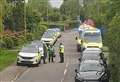
Police have warned that driving conditions on the M20 between junction four for Leybourne and junction nine for Ashford North are especially difficult.
At the East Malling Weather Station, the temperature hovered around a bitter 1.5 degrees for much of Easter Saturday and Sunday.
National forecaster Anton Muscat said: "By Sunday afternoon, the area of rain, sleet and snow that moved down from the north west of the country will begin to fragment and it will turn much more showery, especially across west Kent.
"Snow is rain falling through cold air, so you need a temperature of under 1C to see it. Most of Kent will become too mild by Sunday afternoon.
"However, winds coming across the sea in northern and eastern parts of Kent could still mean wintery showers into Monday, but it's unlikely to be on the scale of Sunday morning."