More on KentOnline
More on KentOnline
Parts of Kent could be hit by flooding with heavy showers and thunderstorms on the way.
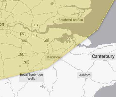
The Met Office issued a yellow thunderstorm warning covering half the county between midnight tonight and the same time tomorrow (September 2).
Meteorologists warn where flooding or lightning strikes occur, there is a chance of delays and some cancellations to train and bus services.
There is also a slight chance that power cuts could occur and other services to some homes and businesses could be lost, they said.
The onset of poor weather could also bring about difficult driving conditions and some road closures with a “small chance” that some communities could be temporarily cut off by flooded roads.
On Monday, areas of heavy showers and thunderstorms are likely to be ongoing from overnight and expected to continue to affect parts of the Kent including Dartford, Gravesend, Sevenoaks, Medway, Maidstone, Sittingbourne and the Isle of Sheppey.
The focus for thunderstorms and its impacts is expected to gradually move east later in the day.
The Met says the extent of these thunderstorms remains very uncertain and while many places will miss them, some places may see 30 to 40 mm of rain fall in less than an hour and perhaps over 60-80 mm in one or two places.