More on KentOnline
More on KentOnline
Home Whitstable News Article
Stop for a moment and consider an event so dramatic, so traumatic it would forever shape our coastline.
Because on this day, January 31, in 1953, a huge tidal surge propelled by strong winds toppled sea defences in the county and, in certain areas, saw the sea ingress two miles inland.
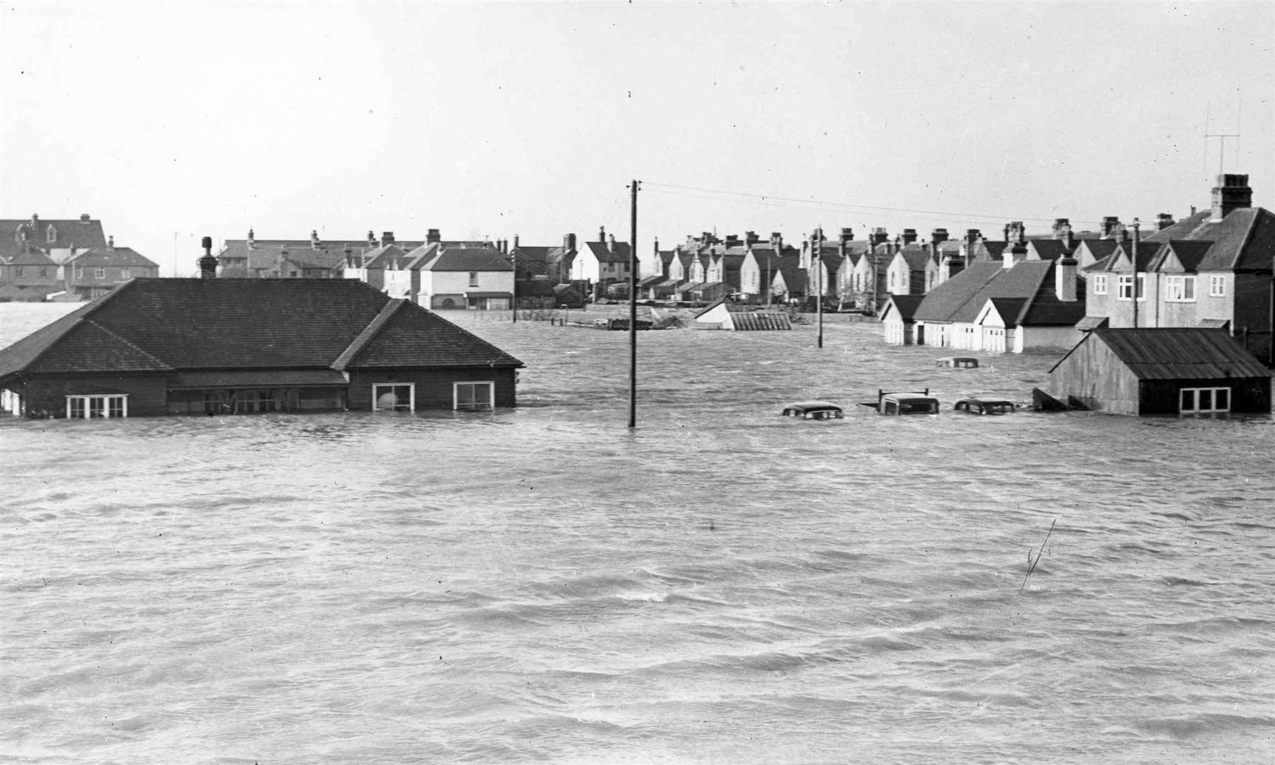
Towns were left under feet of water, cattle and sheep drowned by the thousand, more than the equivalent of £100 million of damage was caused and transport links were left in tatters for months. Even a lighthouse was brought crashing down.
Yet, remarkably, Kent escaped any fatalities. Elsewhere, down England’s east coast, some 300 people were killed.
Such was the impact, at a Canterbury by-election held just weeks later, the turnout was almost halved as the people of Whitstable and Herne Bay continued to mop up.
In an era before the instant mass communication platforms we have today, many were caught completely unaware.
Beryl Waters was the landlord of the Pearson’s Arms in Whitstable at the time.
She said: “The first rush came like a tidal wave right over the top of the house - I thought it was the end for me.”
The water comfortably engulfed the ‘new’ sea defences at the time - installed just the year before.
Reports detail how it surged between the pub and what is today the Whitstable Oyster Fishery restaurant, down into the high street and leaving much of the town centre submerged under feet of water.
Police became aware of the danger approaching around 10.45pm, when the rising tide exceeded expectations. The few officers on duty rushed along seafront properties trying to alert as many as possible to what lay ahead - urging those they could reach to warn their neighbours.
It was a Saturday night when the tides started to breach sea defences - the seawater surging with considerable ferocity into the surrounding coastal streets.
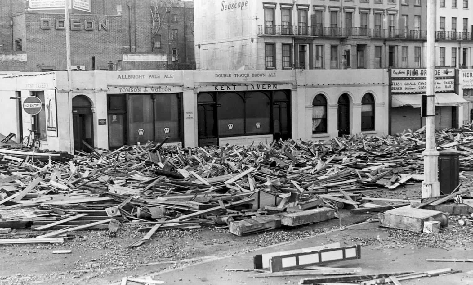
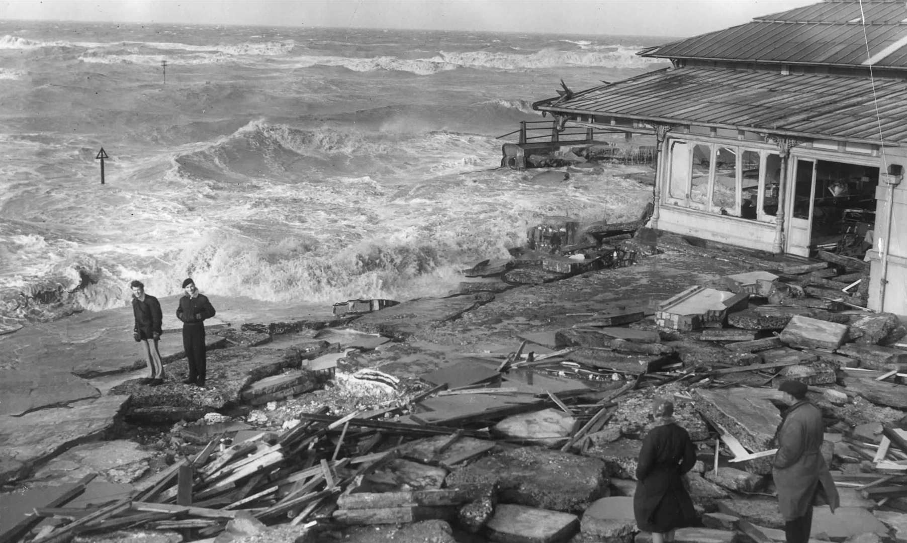
Neighbouring Herne Bay saw its seafront flooded, causing “indescribable damage”. Richmond Street, Mortimer Street and William Street were all submerged.
Half-a-mile of beach huts were ripped up and shattered - sending spears of wood floating on the tide and into the streets
Reports spoke of firemen “up to their necks in water” and rescuing those who lived in cottages near the King’s Hall events venue in the town.
The nearby medieval Reculver Towers survived, but seawater eroded the mound on which the structure sat - exposing human remains thought to have been buried there in centuries gone by. Eye-witnesses at the time reported that from the towers “nothing but water” could be seen.
In the aftermath, cliffs at Beltinge eroded and collapsed - dropping a cliff path by 100ft.
Further along the coast, few places were left untouched.
Faversham saw up to 25,000 acres flooded with more than 100 homes swamped by up to five feet of water. There were reports of boats being found in fields in Oare, dumped by the tide inland of the sea wall. There were sightings of two pianos floating in the old Willow Tap pub in Church Road, Faversham.
The rail line between Faversham and Birchington was made impassable due to flood water. Train users were advised the line would be closed for at least four months, although by March some sections were back in action.
Some 9,000 acres of land between Deal and Sandwich were engulfed by water. One farmer alone lost more than 700 chickens, nearly 200 sheep and reported damage to his land which would take months to restore.
In Margate, Tom Mead, then 33, of King Street, recalled: “I went downstairs early on Sunday morning and found the table floating around the kitchen. I rescued the Sunday joint as it went floating by.”
Margate - which also lost its original lighthouse on the harbour arm - was said to have suffered around £500,000 damage, equivalent to nearly £12 million today.
Countywide, initial estimates put the loss of livestock at around 10,000 sheep and 1,000 cattle.
Along 120 miles of sea defences stretching from Woolwich in south east London to Deal, there were some 300 breaches - all bringing a devastating impact to local communities.
As water pulsed into homes and businesses, power was cut and phone lines went down.
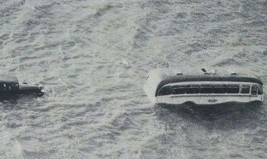
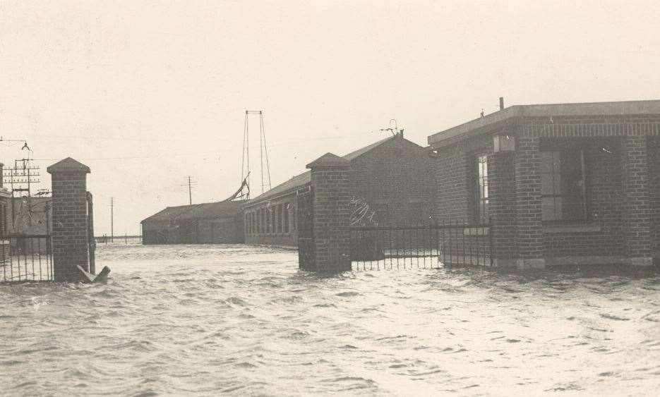
Sheppey was extensively impacted - with the island effectively cut off as road and rail links were hampered by deep floodwater and damage. Four people on the Kingsferry Bridge were marooned there for a day after the waters left them cut off before being rescued.
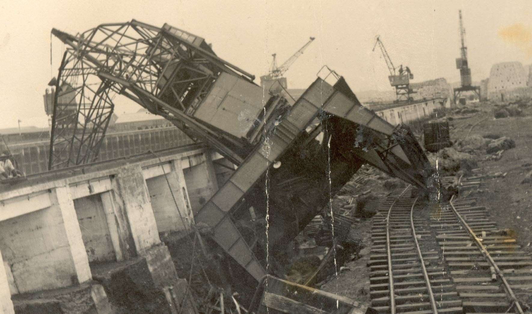
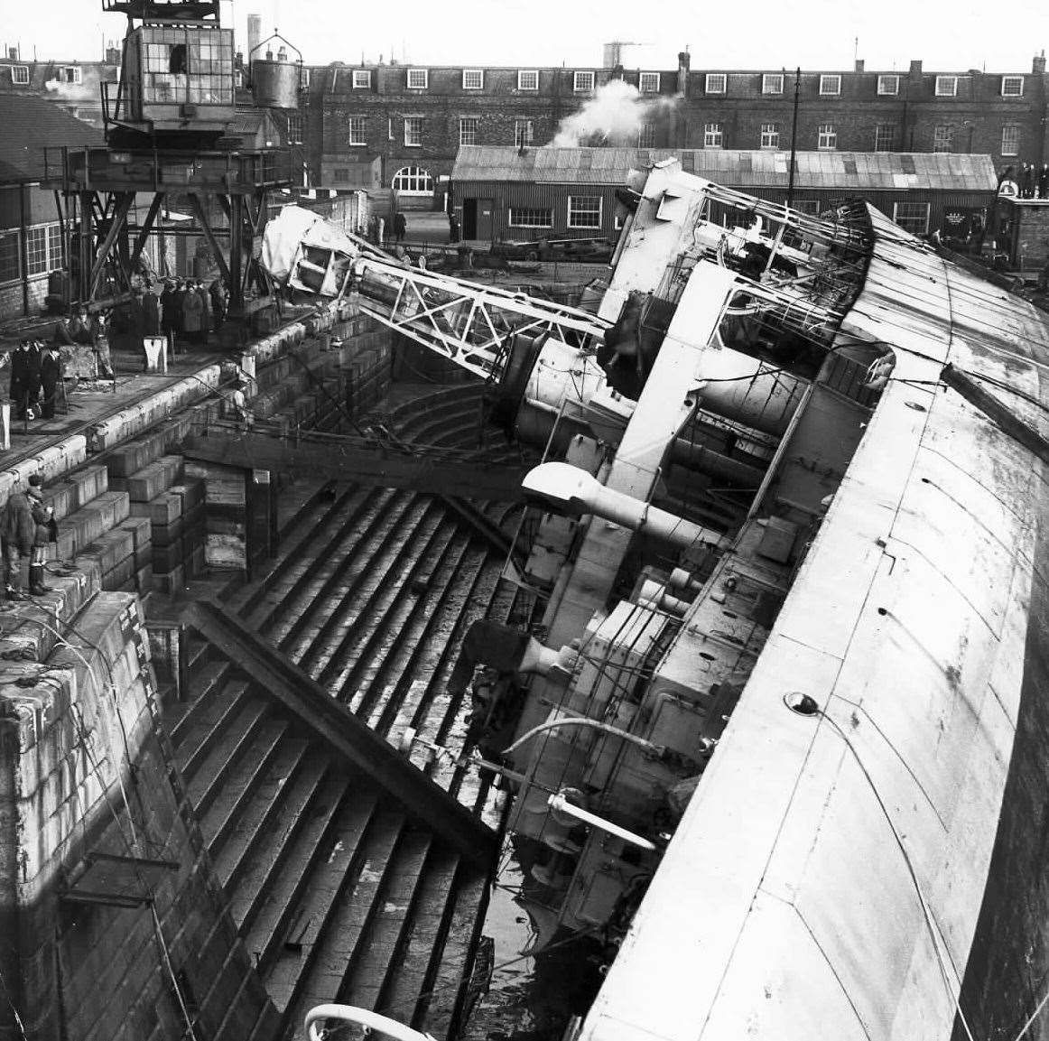
Sheerness Dockyard saw £1.5 million worth of damage caused - the equivalent today of £35.5 million - in what was described as the “worst peace-time catastrophe yet” by an official at the site.
“The tide was 10ft was above normal - and four foot higher than the 22ft flood wall,” explained JE Melville, civil secretary to the captain-in-charge, at the dockyard.
“The wave went over the top of the dock gates and into the dry dock. The submarine Sirdar was sunk, and the frigate Berkeley Castle rode high on the waters and eventually turned over and capsized.
“Dockyard officers, who had been called out at midnight, could only watch the havoc - probably the worst disaster in dockyard history.”
The captain-in-charge at one point had to climb a ladder and take refuge on a rooftop.
Medway was hit hard as water flowed out of the estuary and onto land.
Robert Bowman, of Medway Street, in Chatham, said at the time: “The first I knew about the flood was when I was awakened by the sound of rushing water outside the house. I hurried downstairs and managed to put the furniture at a higher level before the water started pouring in under the front door”.
Low-lying areas across Chatham, Rochester and Strood were all badly hit with cellars left resembling swimming pools and hundreds of homes affected.
Gravesend saw bad floods in West Street and Gordon Gardens, while Northfleet riverside was partially submerged.
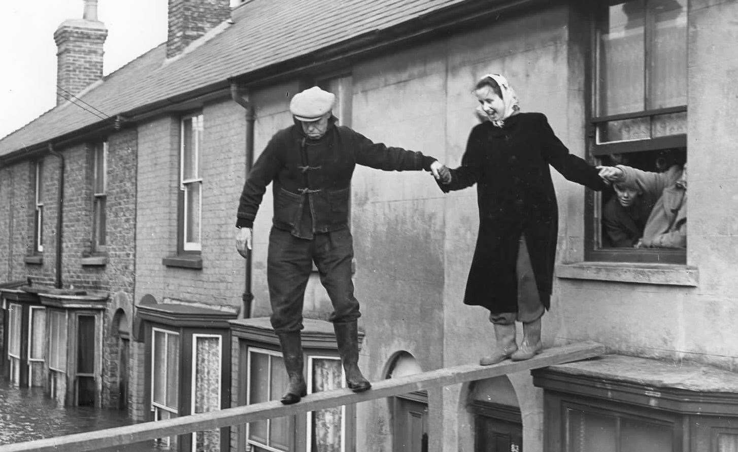
Even as far inland as Maidstone was impacted as water broke the banks of the Medway as it rushed up the river. Pictures show parts of the High Street flooded - with people having to walk on raised planks to pass the floodwater.
The oil refinery on the Isle of Grain had only just been completed and its opening was delayed by three weeks as the clean-up process got under way.
So what caused the sea surge? It was, excuse the pun, something of a perfect storm of issues converging in one dreadful night.
High spring tides had already made water levels higher than normal - which was exacerbated by low air pressure. Then there were northerly gales, which, combined with the high tides, drove water down the east coast. Low-lying areas were particularly vulnerable.
Lincolnshire and East Anglia were both badly hit, as was Essex - with more than 300 people killed across the UK. The water surged up the Thames too, damaging parts of east London - including the Royal Docks. The total cost of damage in the UK was put at some £50 million - the equivalent today of £1.1 billion.
But the worst affected area was the Netherlands and Belgium. The famously flat region was swamped and more than 1,800 deaths were recorded.
The situation was exacerbated by coming just eight years after the end of the Second World War. Sea defences had been damaged during the conflict and poorly maintained. In addition, many people both in the UK and elsewhere were living in temporary, prefab homes, often sited in coastal areas. Few were built to survive such an onslaught of water.
The Netherlands embarked on building an ambitious new sea defence system, designed to prevent any repeat. Remarkably, the multi-billion-pound project, known as The Delta Works, was only fully completed in 1997.
In the UK, work began on the Thames Barrier to prevent a surge heading into London and causing more extensive damage. It opened in 1984.
Along the Kent coast, sea defences have, over the years, been added to in a piecemeal approach. Today, the pressure on weather conditions ushered in by climate change - triggering an irreversible increase in tide levels - suggest more flooding is perhaps inevitable.